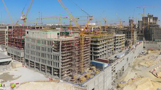
International Construction
The world's most successful construction companies trust EarthCam's global experience and webcam technology to monitor, document and promote their projects.
Experience the World's Favorite Construction Camera Technology
View jobsite activity live in streaming video or capture megapixel photographs for documentation and marketing.
Time-Lapse Cameras


Live Streaming Cameras


Camera Options


Time-Lapse Cameras
Live Streaming Cameras
Camera Options
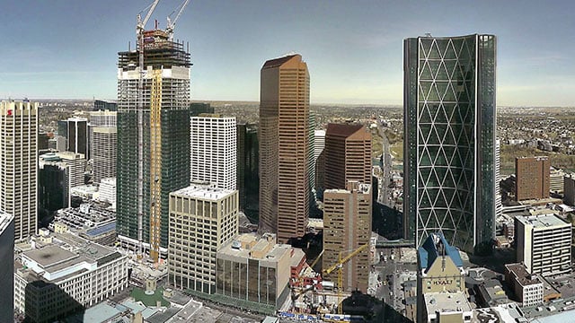
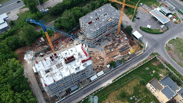
Construction Documentation
View jobsite activity remotely in real-time to make informed decisions quickly. Document progress with high-quality imagery and archive for historic record. The visual content is easily to analyze and can be shared across your organization for enhanced communications.
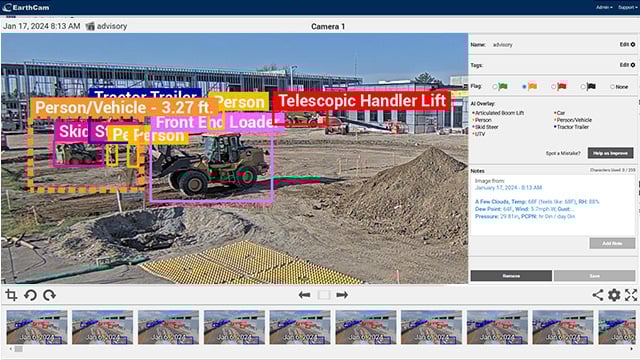
AI for Safety, Security & Productivity
AI Media Dashboard is a rich visualization tool that generates automated in-app alerts for AI-detected events and observations, such as and PPE advisories or when workers are at height or in close proximity to energized equipment. Share real-time status of personnel, equipment and materials and easily find video of specific events using Boolean search.
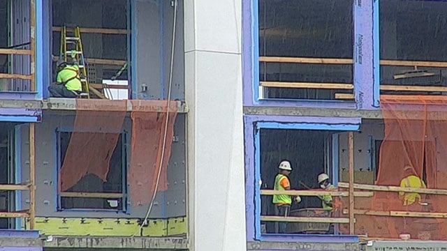
Advanced Security Services
Monitor construction activity and track progress on the jobsite with high-quality construction camera technology. Rely on HD security recordings for real-time status updates regarding your entire project site, including the perimeter and surrounding areas. EarthCam systems are engineered for continuous observation, allowing you to protect important locations and critical infrastructure.
Edited Time-Lapse Movies
Promote your projects with automatically-generated time-lapse videos using Control Center 9 or consult with our award-winning producers who will customize a cinematic finished product. Promote your projects to the public to generate excitement and share your dynamic video online.
Better Lives Through Visual Information®
EarthCam Air – UAV & 3D Geospatial Imaging Service
Maximize the benefits of your project documentation process by combining all-weather cameras and 3D imaging with EarthCam's UAV and aerial imagery services. EarthCam Air also provides cloud-based storage solutions and distribution tools for sharing the unique content derived during UAV flights over your jobsite.
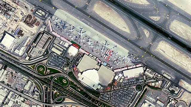
Satellite Imagery
From space, air and ground, EarthCam covers your jobsite documentation needs. We will fly a satellite to map, monitor and measure the entire scope of any engineering or infrastructure project from 0.5-meter resolution imagery. The 0.5-meter resolution imagery is so accurate that it discerns an object on the ground approximately 16 inches in size using both multispectral imagery and panchromatic imagery.
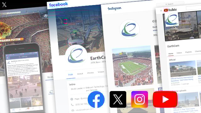
Marketing and Promotion
Act as a virtual passport by delivering views of your construction project to viewers worldwide. Send a powerful message about your international jobsite and your company using EarthCam's wide array of media marketing services. Increase public awareness, enthusiasm and gain new sales with an interactive webcam page created by our dedicated Website Development Team. Drive traffic to your website by sharing impressive images and video on social media sites such as Facebook, Twitter and YouTube.
Software - Control Center 9
Discover the most intuitive, efficient, feature-packed suite of utilities enabling secure, web-based control of multiple camera systems through a local network or Internet connection.
- Live stream secured & encrypted
- Flexible archiving options
- Instant Presentation-Ready Time-Lapse
- Weather data - current & historical
- Take instant snapshots anytime
- Email, save & share content
- Easily embed in any website
- Satellite map & site plan integration
- Image mark-up & comparison tools
- Automated progress reports
- Continuous support & training