EarthCam Air Aerial Imagery and UAV services

See the bigger picture with aerial imagery and video that provides critical context beyond ground-level views. By capturing high-resolution orthomosaic visuals from above with comprehensive AI analytics, customers gain a clearer overview of site conditions, progress, and scale, helping teams align faster and make informed decisions.

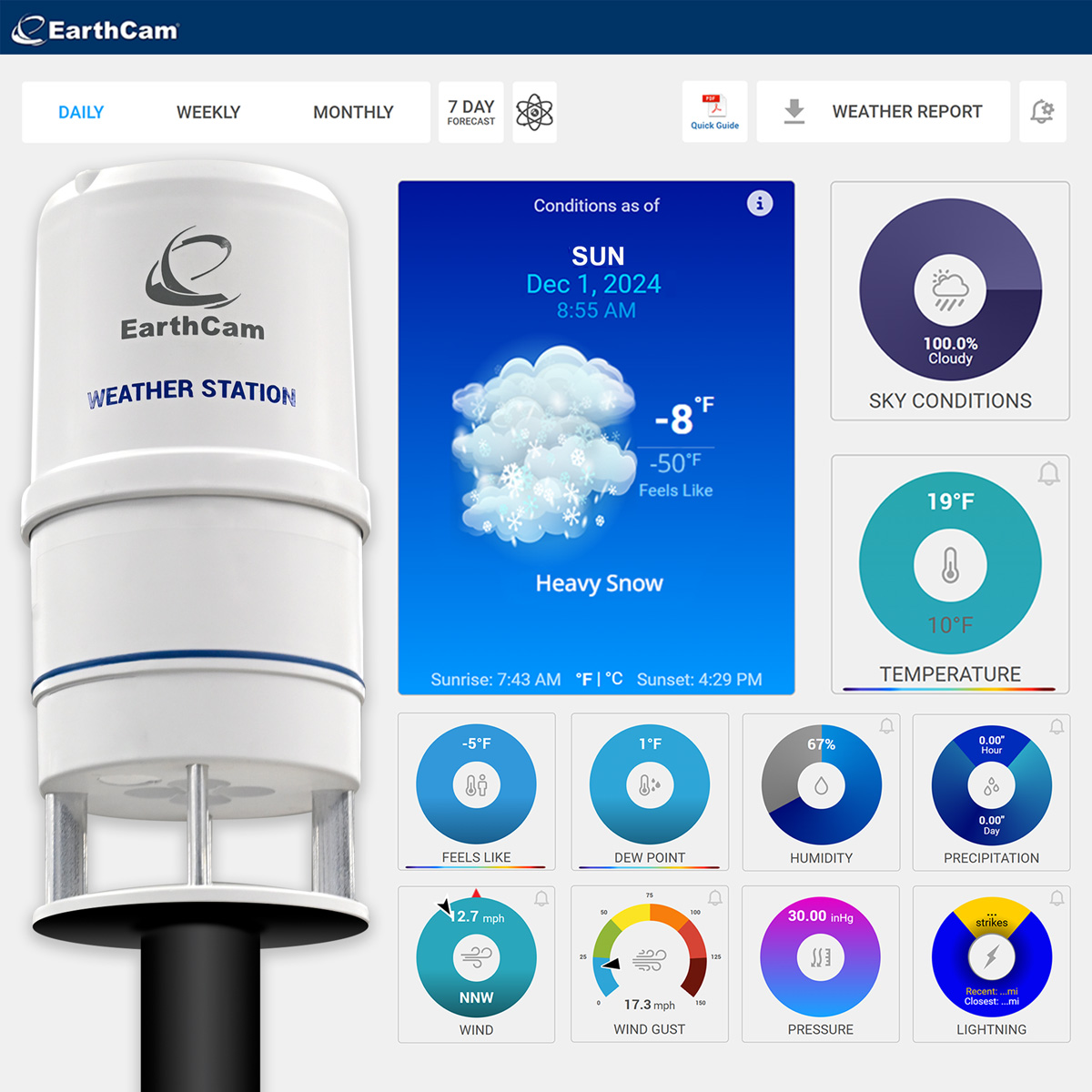
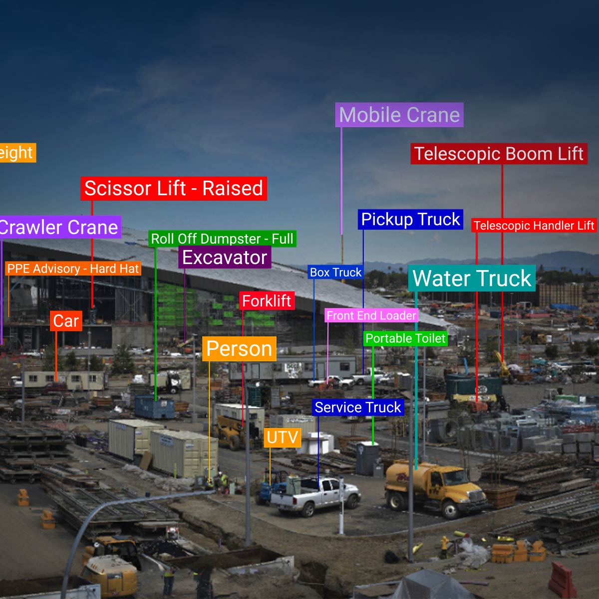
Understand sites at scale

Aerial perspectives from drones are stitched together from photos into a continuous image to reveal patterns, relationships, and progress that are difficult to grasp from the ground, reducing miscommunication and creating a shared visual understanding.

AI analysis on drone photography

EarthCam AI identifies equipment and assets in drone imagery, delivering structured visual data direct to Control Center. The entire jobsite can be easily photographed and automatically analyzed, enabling project teams to track assets over time, validate staging and check utilization. Key insights support lean construction practices and help verify progress against schedules.

Geo-tagged photography

Combine interior and exterior geo-tagged imagery to EarthCam’s Control Center platform for a comprehensive visual history of your project. The drone-flight delivers an accurate orthomosaic map, while VR Site Tour automatically assembles 360° images into a guided tour of your jobsite on the ground.

Plan with greater clarity

Regular aerial captures see the full site and its surroundings, enabling teams to anticipate challenges, coordinate resources, and move forward with confidence.

Explore aerial visual intelligence

Talk to us about how EarthCam Air can integrate aerial imagery with ground-based visuals for a complete, connected view of your environment.