
Space, Air and Ground Imaging
The innovators in construction camera technology also offer photography documentation from a 3,000,000 foot elevation to a 3 inch interior detail.
Advanced Visualization Services
Improve jobsite efficiencies from groundbreaking to project completion with innovative imaging technology and services.
Project Documentation
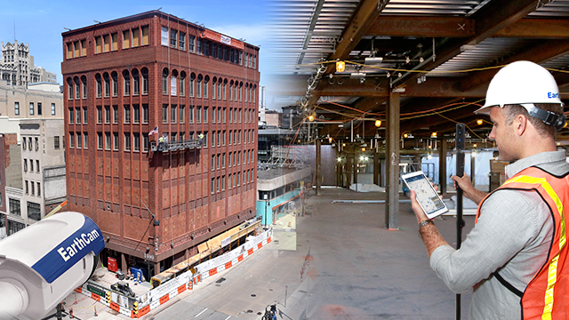
Document your entire construction project, inside and out, using EarthCam construction cameras and photography documentation services. Document jobsite activity using live streaming video or HD imagery, while capturing inspection-grade photographs of interior progress. Integrate the unique content into site plans and share with colleagues for enhanced team communications.
Discover. Explore. Connect.
Live Webcams
Our innovative line of live streaming video and high-quality time-lapse solutions are engineered to monitor, document and promote projects of all sizes. From consultation to completion, EarthCam has the expertise to put this technology to work for you today.
- High-resolution webcam imagery and panoramas for historical archives
- Document interiors for a visual record of pre-existing and as-built conditions
- Make informed decisions more efficiently with valuable visual data
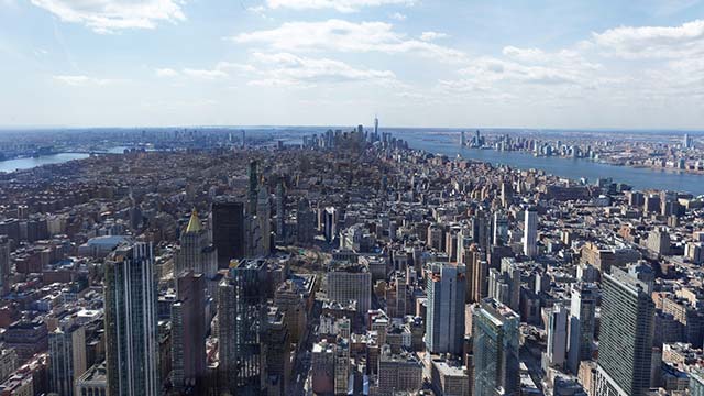
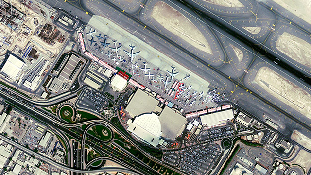
EarthCam Air
Maximize the benefits of your project documentation process by combining all-weather cameras and 3D imaging with EarthCam's UAV and aerial imagery services. EarthCam Air also provides cloud-based storage solutions and distribution tools for sharing the unique content derived during UAV flights over your jobsite.
- Comprehensive analytical report with countless benefits and insights
- Geospatial webcam mapping platform that can be built upon throughout the construction process
- Licensed pilots and professional videographers captured data-driven imagery and entertaining content
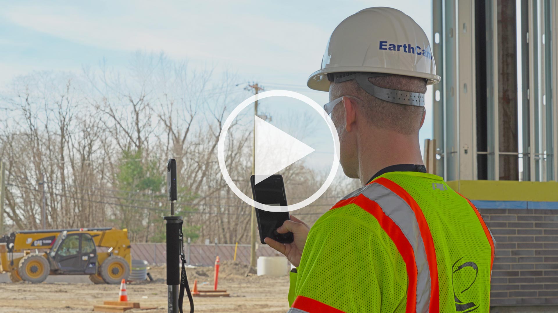
VR Site Tour
EarthCam's VR Site Tour App is specifically designed for quick, straightforward DIY reality capture for small-to-medium jobsites. Capture and communicate interior progress with interactive 360° images automatically assembled into a virtual project tour. All images are geo-tagged to properly align with the site plan. Evidence actual live progress, reduce the need for site visits, and prevent rework.
- Walk through a virtual jobsite using 360° photos of interior construction
- Capture photos using your phone, which are automatically geo-tagged to site plans
- Save, email and share photos in real-time with project team members
On-site Photographer Services
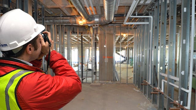
On-site Photographer Services
For a hassle-free experience, depend on EarthCam's worldwide professional network of on-site photographers. These qualified specialists can manage the entire process, capturing pre-demolition, pre/post-slab progress and MEP for a complete visual record of your project. With nationwide coverage in every major city across the US and multiple camera and lens options, choose the cost-effective solution to document your project's milestones.
- Rely on experts to capture, upload and index jobsite images
- Create an indisputable record of as-built and pre-existing conditions
- Flexible hours let you work around your schedule
Gigapixel Photography
The ultimate in jobsite documentation, EarthCam photographers provide 1, 5 and 10 gigapixel panoramas. These images, comprised of over 10,000,000,000 pixels, are customized per project to highlight and enhance the tiniest details of your construction progress. Advanced software automatically stitches together multiple megapixel snapshots into a seamless, non-pixelated 10,000 megapixel image. Blow away the competition with a unique and compelling picture that only EarthCam can provide.
- Document large areas from great distances
- Zoom in to this high resolution panorama to resolve conflicts
- Market and promote your company as an industry leader by using the latest in camera imaging technology
Click here to see the 16 gigapixel U.S. Bank Stadium Panorama
Satellite Imagery
Satellite Imagery
EarthCam utilizes satellites to map, monitor and measure the entire scope of any engineering or infrastructure project from 0.5-meter resolution imagery. The 0.5-meter resolution imagery is so accurate that it discerns an object on the ground approximately 16 inches in size using both multispectral imagery and panchromatic imagery.
- Create custom photographs of your jobsite from commercial satellites
- Economical way to review and inspect remote sites and large areas
- Coverage is up to 100 sq kilometers (38.6 sq miles) per pass