
-
 Premiering 9th Generation Autodesk Integration"With the modelling overlay - it was just
easy and fantastic."- Steven Brooke,
Digital Delivery Manager
Burns & McDonnell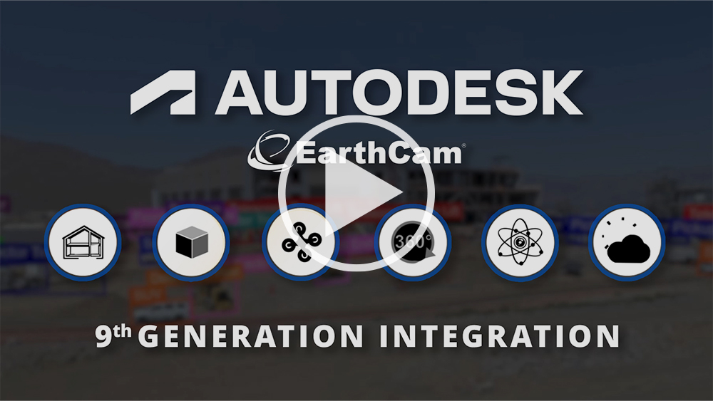
Infuse Digital Twins With Live Imagery, AI and Alerts
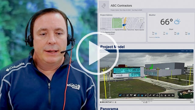
Improve visibility for project management with real-time insights in Autodesk Construction Cloud
9th Generation Integration for Visual Information
Seamlessly align live-camera streams with Revit® or Navisworks® 3D models to provide clear visual evidence of progress for VDC teams. Automatically deliver detailed AI-powered reports, weather and indoor air quality logs with accompanying live imagery directly to Autodesk® Build.


Autodesk User? Log in here

Better Lives Through Visual Information®
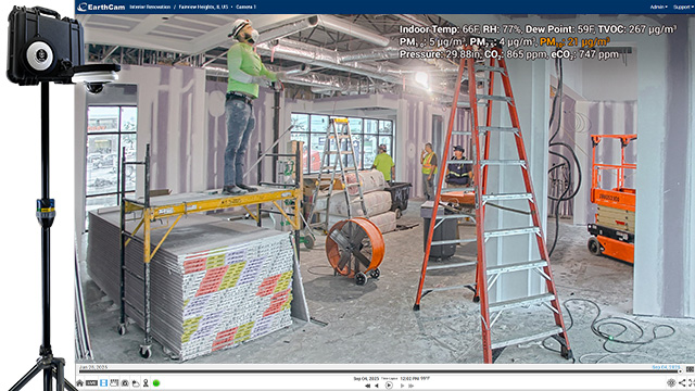
NEW! Mobile StreamCam Robotic with Air Health
Protect workers & occupants by reporting on environmental conditions and pollutants for interior projects. Automate Autodesk Issues to prompt corrective action for potentially hazardous dust, chemicals or VOCs. Add records to Docs confirming temperature and humidity levels complied with material application guidelines.

Quickly & Easily Merge Live Streams with Digital Twins
Customize, create and save different layered views within the Forge Viewer. Superimpose images and video over your choice of 3D model layers. Drill down into layers and model branches to select the exact 3D model components to incorporate with your imagery. Provide intelligent perspectives of jobsites with digital twins throughout the entire project lifecycle.

Automated Reporting for Weather, AI
Automate delivery of detailed PDF AI reports to Autodesk Docs and Forms for a summary of jobsite conditions. Reports include useful data-points for context, such as jobsite activity heat maps, recent equipment arrivals and the times when activity started and finished.

World's First AI Material Analysis
The first service ever to combine real-time jobsite cameras with a specialized AI to identify, highlight, and indicate the spatial configuration of materials within the environment. Materials are annotated, and work-in-place verification is automatically added to project management dashboards.
Automate Image Uploads, Share Directly to 'Issues'

Automate Image Uploads, Share Directly to 'Issues'
Automate visual data uploads that help construction teams execute quicker and make better, data-driven decisions. Deliver webcam, 360 VR photography and video content to Autodesk Build for a media-enhanced view of any project. Augment draft/open RFIs and Issues with annotated photographic evidence.

Live Weather Service
Live Weather Service with real time monitoring puts 16 points of onsite live weather data at your fingertips. EarthCam's service features new weather sensors combined with live cameras to automate a complete record of jobsite conditions. Address potential risks before they escalate with 128 different advisories, watches and warnings, powered by NOAA.
Webcam Imagery, 360° Reality Capture, and AI-Edited Time-Lapse Videos
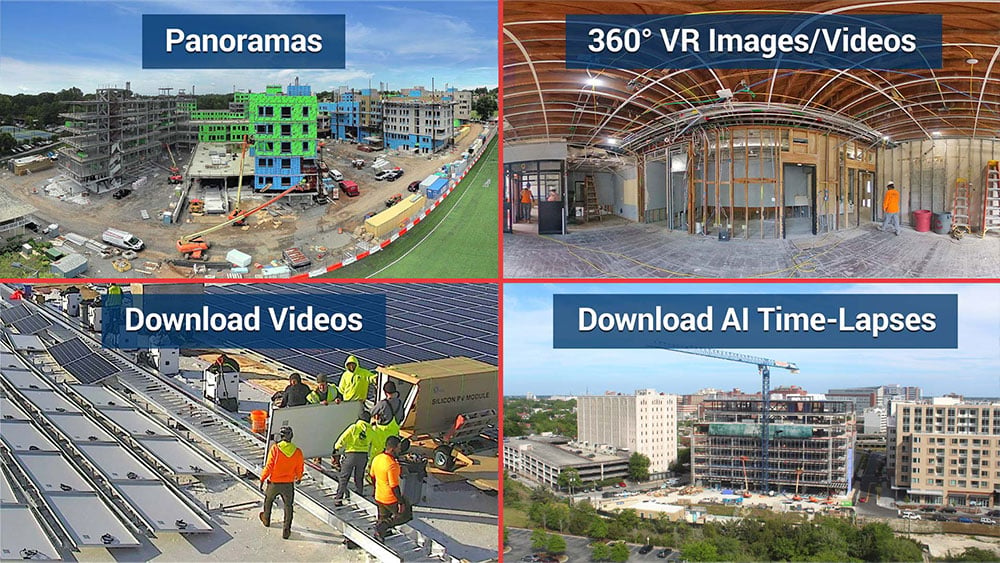
Webcam Imagery, 360° Reality Capture, and AI-Edited Time-Lapse Videos
With EarthCam's image comparison, enhancement filters and mark-up tools, you have many options to highlight changes and call out specific areas of interest directly on to photos. In addition, you can instantly share gigapixel panoramas and presentation-ready AI-edited time-lapse videos from the EarthCam interface within the Autodesk platform.
Customize Autodesk Build with EarthCam Partner Cards
Access your live jobsite cameras, time-lapse movies and EarthCam-infused BIM models as part of EarthCam's new Partner Card. Use versatile and cross-platform content to support a lean construction environment. Virtual Design and Construction (VDC) teams can leverage EarthCam cameras already on the jobsite for greater insight into the project process using real-time media.
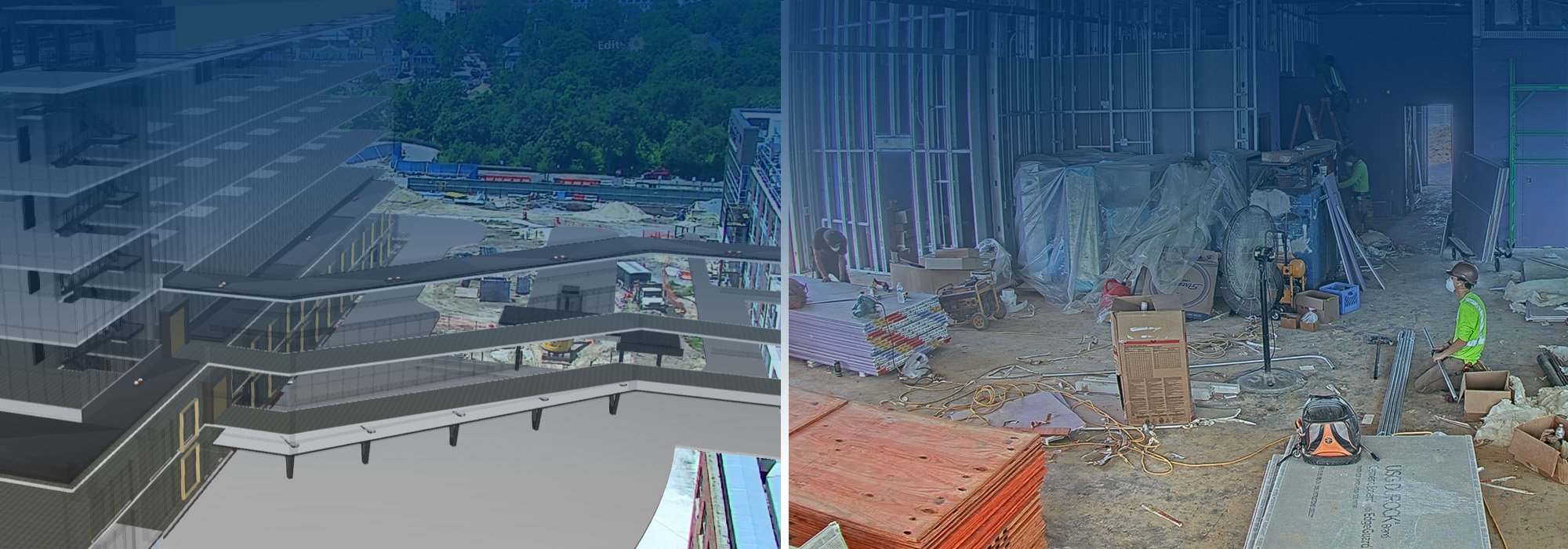
Compare As-Built to As-Designed Conditions
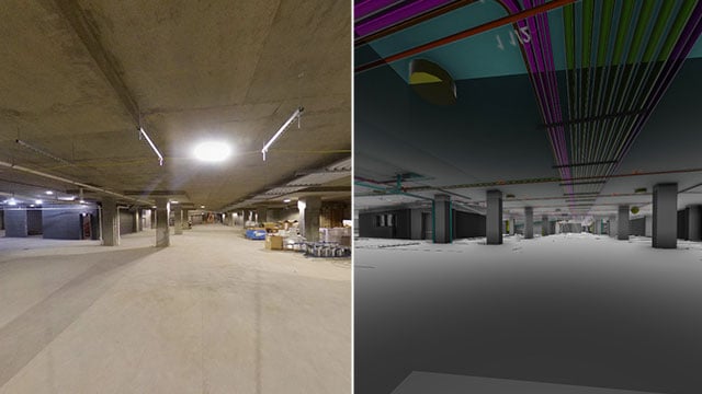
Compare As-Built to As-Designed Conditions
View your EarthCam jobsite cameras and imagery in relation to Navisworks and Revit 3D models. Synched live camera streams are merged with model views, and users can pan, tilt and zoom to reveal architectural details while immediately seeing the corresponding model alignment. Execute measurement functions between webcam images, 2D plans or 3D models.

Autodesk Build Single Sign-on
Access and view your EarthCam construction camera content in Autodesk Construction Cloud with single sign-on (SSO) for Autodesk. EarthCam managed services clients can login using their Autodesk user name and password. For assistance with creating a new EarthCam Control Center 9 account, click here.