Explore 360° Reality Capture
See how VR Site Tour’s panoramic documentation delivers complete visual context and improves coordination across project teams.
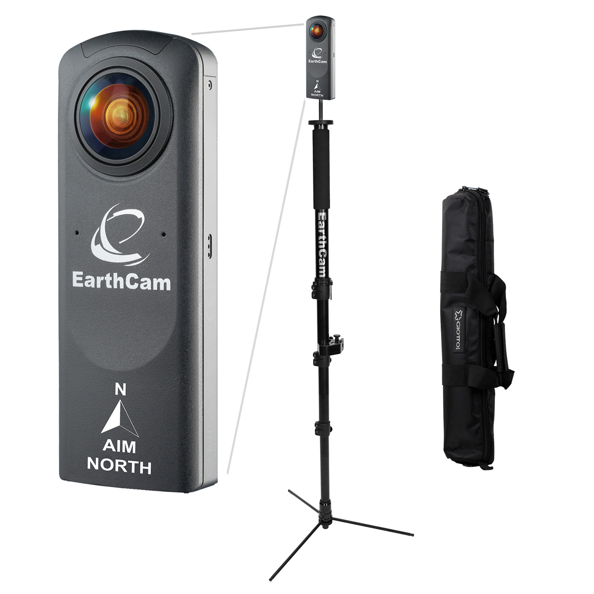
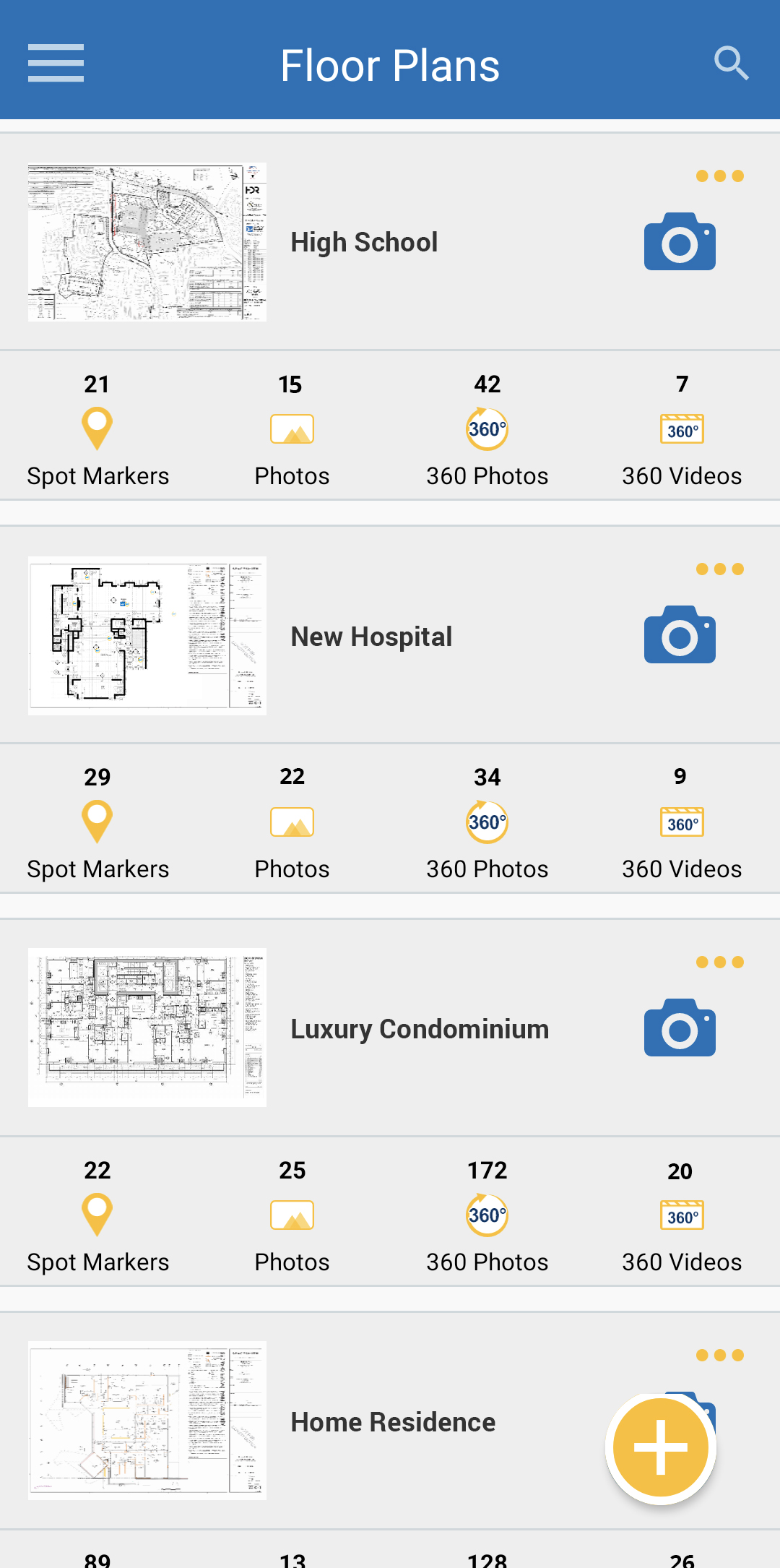
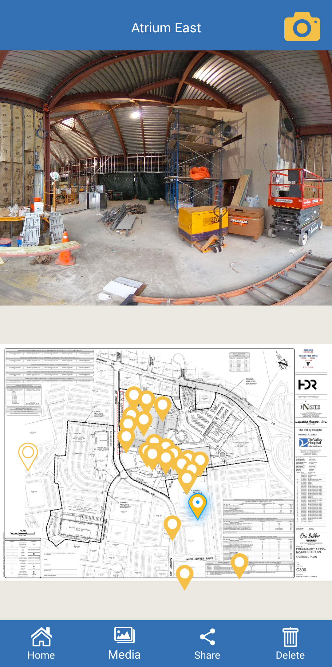
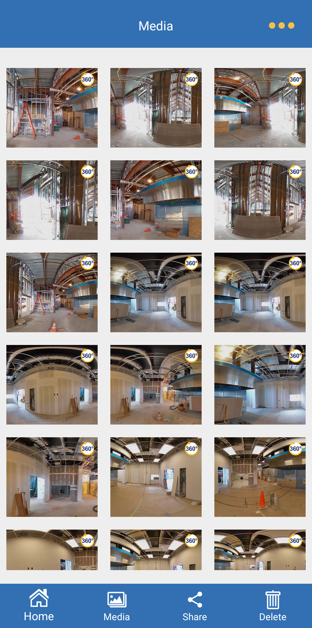
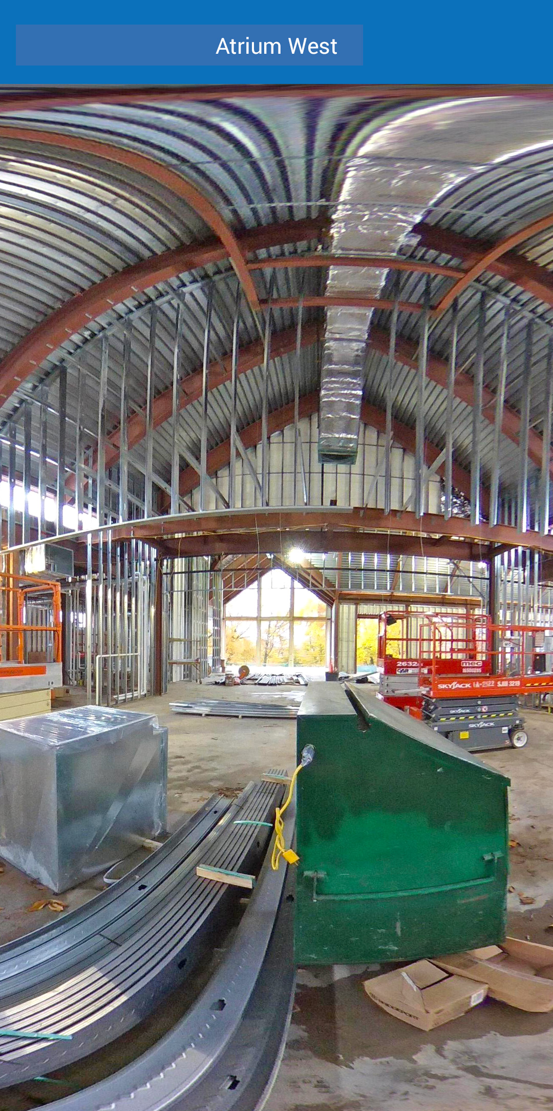
Transform 360° imagery into immersive, interactive tours for collaboration and documentation. EarthCam’s VR Site Tour app is designed for quick, straightforward DIY reality capture for small-to-medium jobsites. Capture and communicate interior progress with interactive 360° images automatically assembled into a virtual project tour. All images are geo-tagged to properly align with the site plan. Evidence actual live progress, reduce the need for site visits, and prevent rework.
Explore 360° Reality Capture
See how VR Site Tour’s panoramic documentation delivers complete visual context and improves coordination across project teams.
VR Site Tour converts jobsite imagery into immersive 360° experiences that bring projects to life. Using reality capture technology, teams can virtually walk through construction sites, review progress, and identify issues without being physically present. These interactive tours improve collaboration between remote stakeholders, reduce travel requirements, and preserve detailed records of conditions at specific points in time. Beyond construction, VR Site Tour also supports training, safety planning, and post-completion documentation, making it a versatile tool for visualization and engagement throughout the project lifecycle.
Integrate 360° reality capture with project management solutions
Upload immersive 360° imagery to platforms such as Procore and Autodesk Build, CMiC and more, to add value and provide greater insight. Push images to 100% of image-ready Procore Daily Log sections for faster collaboration and transparency.
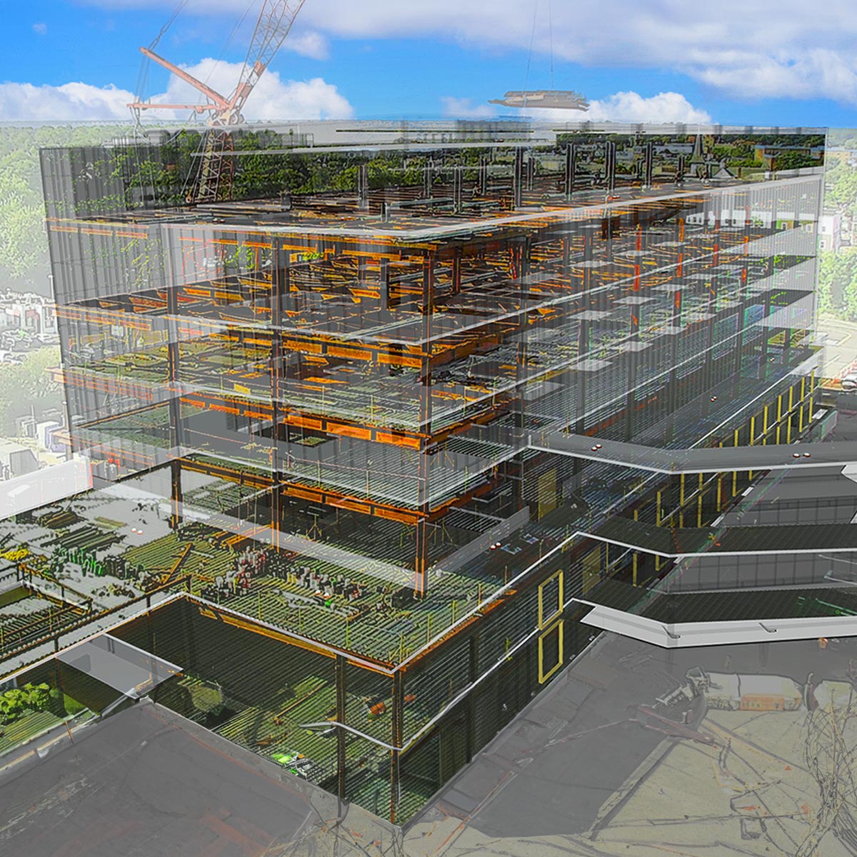
Enhance digital twins with interactive 360° content
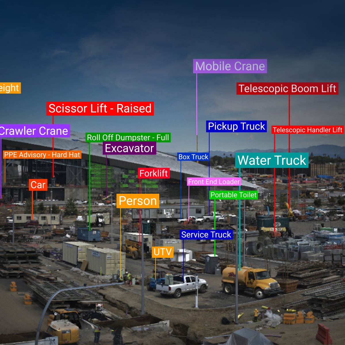
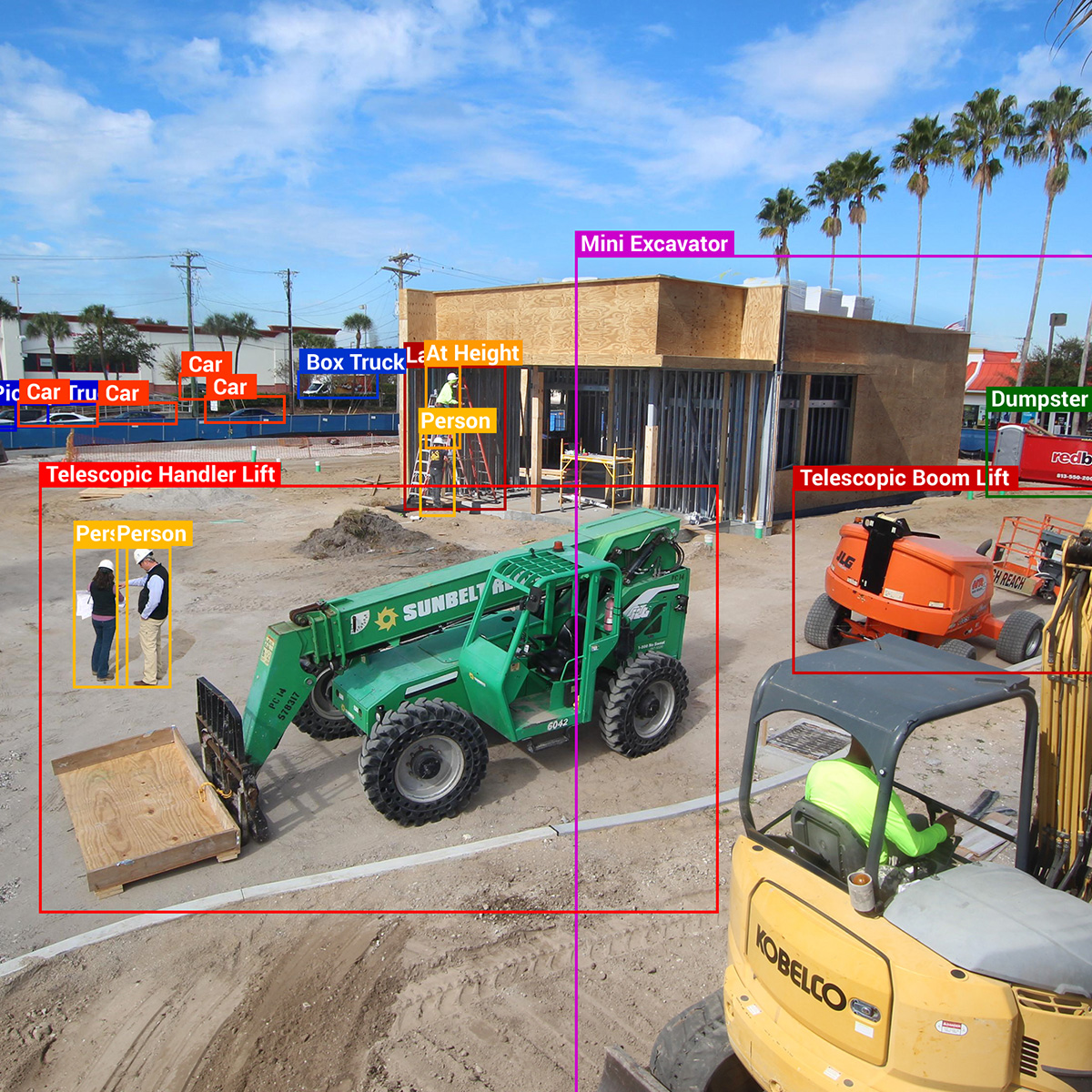
Merge live jobsite cameras, AI and 360° reality capture to answer questions about clashes in near real time and streamline your schedule management. Create a cohesive library of archives for image comparison with your 3D BIM models.
By enabling interactive 360° tours of active sites, VR Site Tour brings stakeholders closer to the project. This immersive access improves transparency, speeds up reviews, and creates lasting records for documentation.
Interactive site tours provide detailed, panoramic visibility, allowing users to navigate projects virtually and understand conditions in greater context.